ANALYSIS OF HAZARD OCCURRENCES IN MIZORAM WITH RESPECT TO RAINFALL
Home > SCCCC > Phase II > ANALYSIS OF HAZARD OCCURRENCES IN MIZORAM WITH RESPECT TO RAINFALL
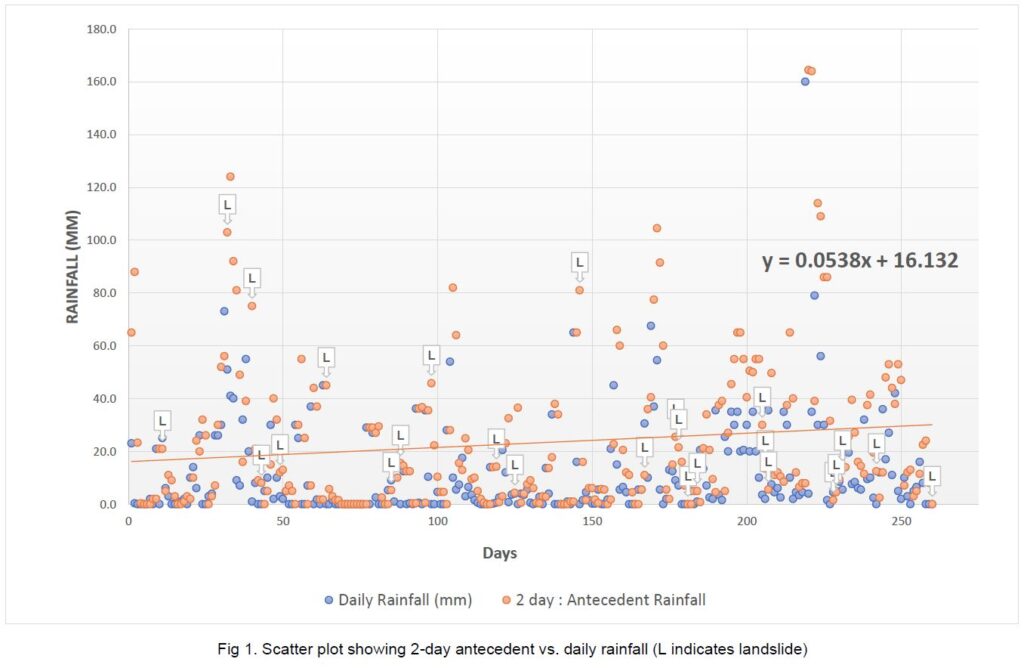
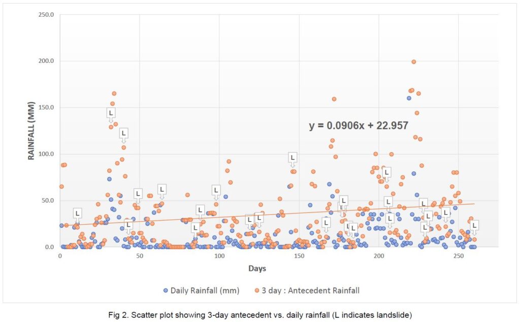
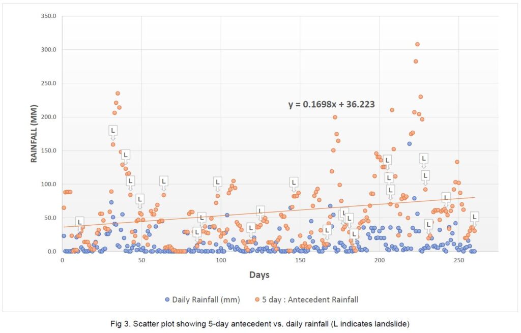
In this analysis, we performed a regression analysis of daily antecedent rainfall with landslides events to identify rainfall threshold that trigger landslides in Mizoram, India. Mizoram lies in the most extreme North-East part of Mizoram surrounded by two international boundaries. The present study is conducted as Mizoram lies in the Seismic Zone – V, which is the highest risk zone to earthquakes and is very prone to landslide events every year causing severe damage to properties road blockage and event loss of lives. A scatter plot analysis is conducted for 2, 3, and 5-day antecedent rainfall vs. daily rainfall. This process resulted in the derivation of rainfall threshold equation for each condition of antecedent rainfall, from the known data for landslide occurring days in the form of a linear equation. Of the three different trend lines obtained, the 5-day antecedent vs. daily rainfall trend line has the most landslide event (7) above the trend line and hence this trend line has been selected as the rainfall threshold equation for the study area (y = 36.2 + 0.09x). The present studies resulted in the inferences that the trend lines from 2, 3 and 5-days antecedent rainfall all have the intercept values in the range of 16.1 – 36.2 mm. This indicates that in the absence of antecedent rainfall, a daily rainfall i.e. approximately ≥ 16 mm could trigger a landslide in Aizawl area. The positive coefficient of the antecedent rainfall, in all the three equations indicates that an increase in cumulative antecedent rainfall results in an increase amount of daily rainfall required to trigger landslide. During the selected 270 days, the daily rainfall was observed to surpass the threshold 67 times, of which thirteen resulted in landslides. The probability of a landslide is observed to be 19% (13/67).


